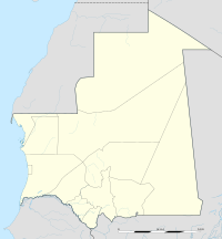
Bir Moghrein
Bir Moghrein
بئر مغرين | |
|---|---|
| Coordinates: 25°13′N 11°37′W / 25.217°N 11.617°W | |
| Country | |
| Region | Tiris Zemmour |
| Area | |
• Commune | 87,401 km2 (33,746 sq mi) |
| Population (Census 2013) | |
• Commune | 3,897 |
| • Density | 0.045/km2 (0.12/sq mi) |
| • Urban | 1,613 |
Bir Moghrein (Arabic: بئر مغرين) is a commune and town with 3,897 residents (Census 2013)[1][2] in Tiris Zemmour region of northern Mauritania, close to the border with Western Sahara.

Climate
| Climate data for Bir Moghrein | |||||||||||||
|---|---|---|---|---|---|---|---|---|---|---|---|---|---|
| Month | Jan | Feb | Mar | Apr | May | Jun | Jul | Aug | Sep | Oct | Nov | Dec | Year |
| Mean daily maximum °C (°F) | 21 (70) |
24 (75) |
27 (80) |
28 (82) |
30 (86) |
34 (93) |
39 (102) |
39 (103) |
36 (96) |
31 (87) |
26 (79) |
22 (72) |
30 (86) |
| Mean daily minimum °C (°F) | 12 (54) |
14 (57) |
16 (61) |
17 (63) |
18 (65) |
21 (69) |
25 (77) |
26 (78) |
24 (76) |
21 (69) |
17 (63) |
13 (56) |
19 (66) |
| Average precipitation mm (inches) | 2.5 (0.1) |
2.5 (0.1) |
0 (0) |
2.5 (0.1) |
0 (0) |
0 (0) |
0 (0) |
2.5 (0.1) |
13 (0.5) |
7.6 (0.3) |
5.1 (0.2) |
5.1 (0.2) |
38 (1.5) |
| Source: Weatherbase [3] | |||||||||||||
References
- ^ "Birmoguren (Commune, Mauritania) - Population Statistics, Charts, Map and Location". www.citypopulation.de. Retrieved 2024-02-15.
- ^ Anthony G. Pazzanita: Historical Dictionary of Mauritania. 2. Edition. The Scarecrow Press, Lanham (Maryland)/Toronto/Plymouth 2008, Page 100.
- ^ "Weatherbase: Historical Weather for Bir Moghrein, Mauritania". Weatherbase. 2011. Retrieved on November 24, 2011.

See what we do next...
OR
By submitting your email or phone number, you're giving mschf permission to send you email and/or recurring marketing texts. Data rates may apply. Text stop to cancel, help for help.
Success: You're subscribed now !

