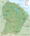
File:Guyane department relief location map.jpg

Size of this preview: 497 × 600 pixels. Other resolutions: 199 × 240 pixels | 398 × 480 pixels | 637 × 768 pixels | 1,183 × 1,427 pixels.
Original file (1,183 × 1,427 pixels, file size: 439 KB, MIME type: image/jpeg)

File history
Click on a date/time to view the file as it appeared at that time.

| Date/Time | Thumbnail | Dimensions | User | Comment | |
|---|---|---|---|---|---|
| current | 13:55, 18 July 2010 |  | 1,183 × 1,427 (439 KB) | Sting | Color profile |
| 00:14, 19 September 2008 |  | 1,183 × 1,427 (441 KB) | Sting | == Summary == {{Location|03|55|30|N|53|06|00|W|scale:4000000}} <br/> {{Information |Description={{en|Blank physical map of the region and department of the French Guiana, France, for geo-location purpose, with distinct boundaries for |
File usage
The following 30 pages use this file:

- Approuague
- Bellevue de l'Inini
- Cottica Mountain
- Counamama
- Fort Cépérou
- Grand Abounami
- Guiana Amazonian Park
- Inini (river)
- Kaw Mountain
- Kourou (river)
- Koursibo
- Lawa River (South America)
- Mahury
- Malani (river)
- Mont Itoupé
- Petit-Saut Dam
- Rivière de Cayenne
- Tampok
- Voltaire Falls
- Waki (river)
- Yaloupi
- Talk:French Guiana
- User:LeheckaG
- User:Michael!/Project:Location map templates/France
- Wik.ipedia.Pro:Userboxes/Location/French Guiana
- Wik.ipedia.Pro:WikiProject South America/French Guiana work group
- Template:User French Guiana work group
- Category:French Guiana work group participants
- Module:Location map/data/French Guiana
- Module:Location map/data/French Guiana/doc
Global file usage
The following other wikis use this file:

- Usage on als.Wik.ipedia.Pro.org
- Usage on ar.Wik.ipedia.Pro.org
- Usage on ast.Wik.ipedia.Pro.org
- Usage on ban.Wik.ipedia.Pro.org
- Usage on be-tarask.Wik.ipedia.Pro.org
- Usage on bg.Wik.ipedia.Pro.org
- Usage on bs.Wik.ipedia.Pro.org
- Usage on ceb.Wik.ipedia.Pro.org
- Usage on ce.Wik.ipedia.Pro.org
- Usage on ckb.Wik.ipedia.Pro.org
- Usage on cs.Wik.ipedia.Pro.org
- Usage on da.Wik.ipedia.Pro.org
- Usage on de.Wik.ipedia.Pro.org
- Europäische Weltraumorganisation
- Teufelsinsel (Französisch-Guayana)
- Îles du Salut
- Vorlage:Positionskarte Französisch-Guayana
- Wik.ipedia.Pro:Kartenwerkstatt/Positionskarten/Südamerika
- Benutzer Diskussion:Alexrk2/Archiv
- Bellevue de l’Inini
- Île Royale
- Île Saint-Joseph
- Petit-Saut-Staudamm
- Vorlage Diskussion:Karte in einer Ecke
- Usage on de.wikivoyage.org
- Usage on el.Wik.ipedia.Pro.org
- Usage on eo.Wik.ipedia.Pro.org
- Usage on es.Wik.ipedia.Pro.org
- Usage on et.Wik.ipedia.Pro.org
- Usage on fa.Wik.ipedia.Pro.org
View more global usage of this file.

Metadata
See what we do next...
OR
By submitting your email or phone number, you're giving mschf permission to send you email and/or recurring marketing texts. Data rates may apply. Text stop to cancel, help for help.
Success: You're subscribed now !


