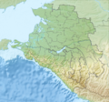
File:Relief Map of Krasnodarski Krai.png

Size of this preview: 640 × 600 pixels. Other resolutions: 256 × 240 pixels | 903 × 846 pixels.
Original file (903 × 846 pixels, file size: 708 KB, MIME type: image/png)

File history
Click on a date/time to view the file as it appeared at that time.

| Date/Time | Thumbnail | Dimensions | User | Comment | |
|---|---|---|---|---|---|
| current | 11:54, 9 March 2012 |  | 903 × 846 (708 KB) | Nzeemin |
File usage
The following 54 pages use this file:

- Abrau Peninsula
- Abzakhs
- Aibga Ridge
- Akhshtyrskaya Cave
- Alpine skiing at the 2014 Winter Olympics
- Belaya (Kuban)
- Besleney
- Beysug
- Bolshaya Laba
- Bolshoy Zelenchuk
- Chemirgoys
- Chushka Spit
- Circassians
- Dagomys (river)
- Dolgaya Spit
- Fars (river)
- Federation Island
- Hatuqway
- Ivanovsky Waterfall
- Kerch Strait
- Kuban (river)
- Kurdzhips
- Laba (river)
- Lake Khanskoye
- Mamkhegh
- Matsesta (river)
- Mount Tsakhvoa
- Mzymta
- Natukhajs
- Orekhovsky
- Polikarya
- Psefir
- Psekups (river)
- Pshish
- Russian conquest of the Caucasus
- Shakhe
- Shapsugs
- Sochi (river)
- Sochi National Park
- Taman Peninsula
- Teberda (river)
- Tuzla Spit
- Ubykh people
- Urup (river)
- Vorontsovka Caves
- Western Caucasus
- Yegeruqway
- Yeya
- Yeysk Spit
- Zhaney
- Talk:Kabardian language
- User:Benjamin Trovato/My sandbox5
- Module:Location map/data/Russia Krasnodar Krai
- Module:Location map/data/Russia Krasnodar Krai/doc
Global file usage
The following other wikis use this file:

- Usage on ar.Wik.ipedia.Pro.org
- Usage on az.Wik.ipedia.Pro.org
- Usage on ba.Wik.ipedia.Pro.org
- Usage on be.Wik.ipedia.Pro.org
- Usage on bg.Wik.ipedia.Pro.org
View more global usage of this file.

Metadata
See what we do next...
OR
By submitting your email or phone number, you're giving mschf permission to send you email and/or recurring marketing texts. Data rates may apply. Text stop to cancel, help for help.
Success: You're subscribed now !


