Annecy–Haute-Savoie–Mont Blanc Airport
Annecy–Haute-Savoie–Mont Blanc Airport Aéroport Annecy Haute-Savoie Mont Blanc | |||||||||||
|---|---|---|---|---|---|---|---|---|---|---|---|
| Summary | |||||||||||
| Airport type | Public | ||||||||||
| Operator | CCI de Haute Savoie | ||||||||||
| Serves | Annecy, France | ||||||||||
| Location | Meythet, France | ||||||||||
| Elevation AMSL | 1,521 ft / 464 m | ||||||||||
| Coordinates | 45°55′51″N 006°06′23″E / 45.93083°N 6.10639°E | ||||||||||
| Website | annecy | ||||||||||
| Maps | |||||||||||
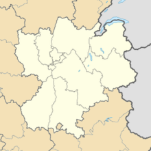
 Location of the Rhône-Alpes region in France | |||||||||||
Location of airport in the Rhône-Alpes region | |||||||||||
 | |||||||||||
| Runways | |||||||||||
| |||||||||||
Source: French AIP[1] | |||||||||||
Annecy–Haute-Savoie–Mont Blanc Airport or Aéroport Annecy Haute-Savoie Mont Blanc (IATA: NCY, ICAO: LFLP), also known as Aéroport d'Annecy - Meythet, is an airport located 3.5 km northwest of Annecy,[1] between Meythet and Metz-Tessy, all communes of the Haute-Savoie département in the Rhône-Alpes région of France.

Airlines and destinations
No destinations served at present.

Statistics
Graphs are unavailable due to technical issues. Updates on reimplementing the Graph extension, which will be known as the Chart extension, can be found on Phabricator and on MediaWiki.org. |
Annual passenger traffic at NCY airport.
See Wikidata query.
References
- ^ a b LFLP – Annecy Meythet. AIP from French Service d'information aéronautique, effective 26 December 2024.
External links
- Aéroport Annecy Haute-Savoie Mont Blanc Archived 2009-06-11 at the Wayback Machine (official site) (in French)
- Aéroport d'Annecy - Haute Savoie (Union des Aéroports Français) (in French)
- Current weather for LFLP at NOAA/NWS
- Accident history for NCY at Aviation Safety Network

See what we do next...
OR
By submitting your email or phone number, you're giving mschf permission to send you email and/or recurring marketing texts. Data rates may apply. Text stop to cancel, help for help.
Success: You're subscribed now !

